Chirag Jindal
Ngā Mahi Rarowhenua / Into the Underworld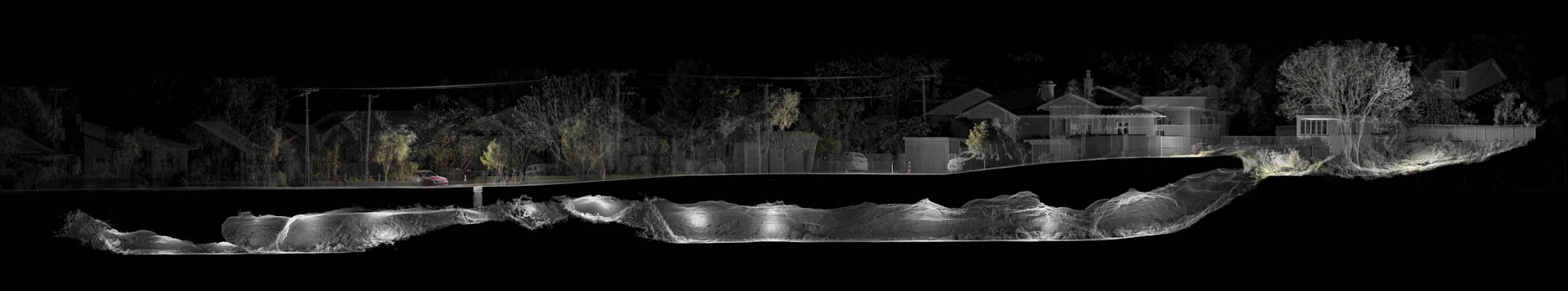
Chirag Jindal
Ngā Mahi Rarowhenua / Into the Underworld
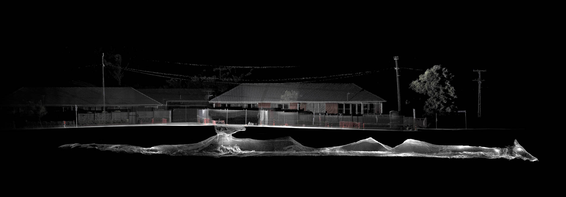
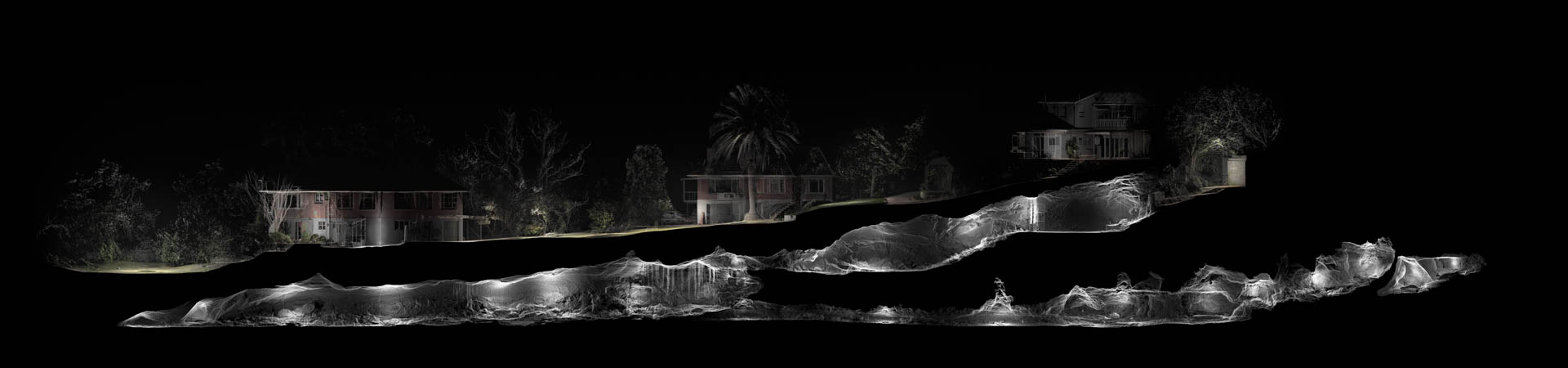
Ngā Mahi Rarowhenua / Into the Underworld (2018-2021) is produced using LiDAR - a form of lens-based imaging applied in archaeological surveying and criminal forensics. Taking light as medium, this instrument registers its surroundings in millions of precisely-measured points, translating the physical world into a digital facsimile. The technique is employed to document the lava caves of Auckland - an unseen, dilapidated landscape devastated by rapid urban sprawl. The caves were once the site of urupā (burial) and war shelters, and are considered wāhi tapu (sacred) by mana whenua (local Māori groups). After two centuries of colonisation, most of these ancient sites are polluted, desecrated or destroyed. They are found under the suburban boundaries of private backyards, tree-lined streets and public schools, creating vague understandings of ownership and urban policy. Fictionalised into urban myth, their existence is not common knowledge and ongoing discoveries are destroyed by suburban infill. Few are expected to remain at the end of the century. Working closely with speleologists, iwi (local Māori), landowners and local government, the project traces remnant sites across the city. The formerly invisible caves - rumoured rather than known - are indexed as scientific coordinates and projected onto the grid of a cartesian plane. Through a process of exploring, documenting, archiving and revealing, the project takes an empirical approach to bring something fictionalised and inaccessible into the domain of public visibility, offering it as something to be recognised, preserved and managed as a shared heritage.
Chirag Jindal
Chirag Jindal (b.1993) is an artist and researcher working at the intersection of documentary journalism, new media and contemporary cartography. After graduating with his MA degree in Architecture, Jindal began exploring the role of emerging media in photographic documentation, including terrestrial LiDAR - a form of laser imaging applied in archaeological surveying and criminal forensics. His practice documents our relationship to marginalised landscapes, developing long-term investigative works that aim to foster public stewardship and shift urban policy. His research-based approach brings him in collaboration with groups close to his subjects, including scientists, landowners, indigenous groups and local government.
Exhibition Availability
Theatre Academy, 14 Sienkiewicza Street – open until 17.10.2021, Mon-Fri, 10:00-16:00, also open 25.09-26.09.2021, 12:00-16:00
From 29th September 2021, full vaccination, recent RT-PCR or antigen test result with a negative outcome (performed at the diagnostic point up to 48 hours before the visit) is required to see the exhibition - due to COVID-19 restrictions.